Island Rivers

All about rivers on the Isle of Wight

  • The Rivers
    • Newport Rivers
      • Fairlee Hole
      • Gunville Stream
      • Lukely Brook
      • Pan Stream and Staplers Stream
      • River Medina and Merstone Stream
    • East Wight Rivers
      • Blackbridge Brook and Wootton Creek
      • Eastern Yar
      • Monktonmead Brook
      • Munsley Bog
      • Palmers Brook
      • Scotchells Brook
      • Wroxall Stream
    • West Wight Rivers
      • Caul Bourne
      • Chine Streams
      • Gurnard Luck
      • Newtown Rivers
      • Rodge Brook
      • Thorley Brook
      • Western Yar
    • Data about Isle of Wight watercourses
  • Chines
    • All about Chines
      • Forming the Chines
      • Changing Chines
      • Archaeology 1
      • Archaeology 2
      • Geology on Show
      • Smuggling
      • Shipwrecks & Lifeboats
      • Chines in Wartime
      • Wildlife of the Chines
      • Life of Leisure
      • Future for the Chines
    • Chines Research & Reports
    • Exploring the Chines
      • Small Hope Chine & Shanklin Chine
      • Luccombe Chine
      • Blackgang Chine
      • Whale Chine, Ladder Chine & Walpen Chine
      • Shepherds Chine & Cowleaze Chine
      • Grange Chine & Marsh Chine
      • Chilton Chine
      • Brook Chine & Churchill Chine
      • Compton Chine & Shippards Chine
      • NW Coast Chines
  • Explore
    • Fishing
    • Multimedia
    • Walks/Rides
    • Exploring the Chines
  • Love Your River
    • State of Our Rivers
    • Best Practice
      • Advice for people living alongside a watercourse
      • Consents
      • Driveway Best Practice
      • Reducing Phosphates
      • Riverine Rights & responsibilities
      • Septic Tank Advice
      • SUDs
    • Issues
      • Flooding
      • Invasive Non-Native Species
      • Litter and other rubbish
      • Sewage discharges to rivers and the sea
      • Water Quality
      • Water Resources
    • Pond Care
    • The Water Cycle
    • Info & Links
    • Get Involved
    • What’s its name?
    • Home learning about rivers
  • Projects
    • Map of Island River Partnership Projects
    • Our Aspirations
    • Current Projects
      • Bringing Beavers Back to the Isle of Wight
      • Catchment Sensitive Farming
      • Farm Capital Grants
      • Himalayan Balsam – Join our Balsam Bashers!
      • Improving the Lukely Brook
      • Lower East Yar Naturalisation
      • Pathfinder
      • Plant Positive – Invasive Non- Native Species Removal
      • River Club
      • Solent Plastic Pollution Hub
      • Wroxall Stream Water Voles
    • Past Projects
      • Dodnor Rediscovered (2018)
      • Gateway to the East (2020)
      • Meanders and Reflections (2020)
      • Medina Houseboats (2016)
      • Septic Tanks
      • Wetland Restoration (2020)
      • Wroxall Stream Enhancements (2020)
      • Wroxall Wetlands 1 (2016)
      • Wroxall Wetlands 2 (2016)
  • About
    • Catchment Based Approach
    • Island Rivers Catchment Plan
    • Our priorities for the Island’s watercourses
    • Legislative Framework
    • Newport Rivers Group
    • Contact
    • Privacy, GDPR and all of that
  • Events
  • News
You are here: Home / Explore / Walks/Rides / Yar River Trail and Wroxall Stream and Scotchell’s Brook links

Yar River Trail and Wroxall Stream and Scotchell’s Brook links

From Source to Sea

Have you ever wondered what it would be like to follow a river on its journey from source to sea? Here on the Isle of Wight you can do just that.

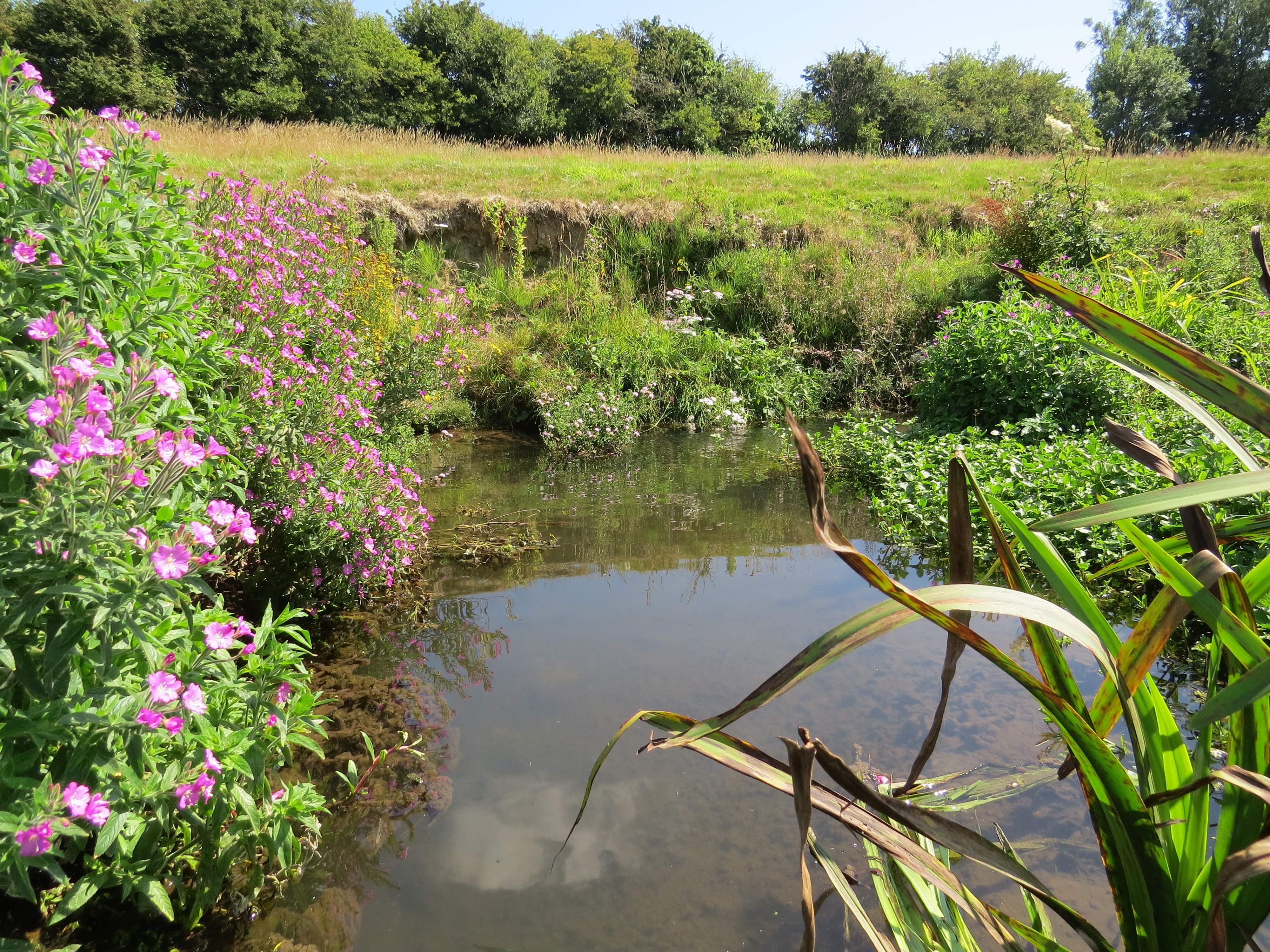
From a spring in Niton you will see the river grow from the smallest trickle and gather itself through a host of tributaries before spreading across its wide floodplain and joining the sea at Bembridge. Along the way the river will guide you through rolling landscapes, past ancient manors and into busy cosy pubs.

This is the Eastern Yar, 19 miles long and the Island’s longest river draining over a fifth of the land surface.

The Yar River Trail is also 19 miles long. Spend a rewarding weekend walking the whole trail and getting to know the Island. Or you could walk one of the four shorter sections each themed on a different stage of the river.  To help you make your mind up we have produced an overview leaflet which can be downloaded or viewed here:
Yar River Trail – cover side
Yar River Trail – map side

All the details can be found by clicking here. The Yar River Trail was established in 2002, and we have been making sure all the way markers are still in place, replacing where necessary. We have also rediscovered the six sculptures along the trail – details of how to find them are here.

We have added two new links to the Yar River Trail. The Wroxall Stream Link is a 7 mile link from the former Ventnor Railway Station, which joins the watercourse at Wroxall and follows it through Arreton Valley to where the Wroxall Stream and the Wroxall Stream Trail join the Eastern Yar and the Yar River Trail.

The Scotchell’s Brook Trail links Shanklin Railway Station with the Eastern Yar and Yar River Trail at Alverstone. It can be walked one – way, follwoing Scotchell’s Brook, or as a circular walk that links back to Shanklin partly following one of the brook’s tributaries.

We will be leading walks along all these trails as part of the 2021 Isle of Wight Walking Festival.

The revamp of the Yar River Trail, and additon of the two new links has been made possible by kind funding from Heritage Lottery Fund through the Down to the Coast project.

Get free updates

To subscribe to our mailing list just complete your details below. We send our periodic newsletters and other important updates about the project.

Connect with us

  • E-mail
  • Facebook
  • Flickr
  • Twitter
  • YouTube

In this section

  • Explore the Scotchells Brook Trail
  • Explore the Wroxall Stream Trail
  • Explore the Yar River Trail
  • Yar 2020 Walks
  • Yar River Sculptures

Hosted by Natural Enterprise Ltd

Island Rivers Partnership, Shide Meadows Centre, Shide Road, Newport, PO30 1HR · hello@islandrivers.org.uk · 01983 201563

Copyright © 2026 Natural Enterprise